Save
You must be signed in to save park lists.
Your Park Lists
add New List
Add Photo
You must be signed in to add photos.
state route ranger badge
Ohio
62

Ohio State Parks

responsive menu icon
USA Parks
Ohio
Northwest Ohio Region
Harrison Lake State Park
Harrison Lake State Park © Doug Holland
Cardinal © stateparks.com
Cardinal
Search
Availability
Calendars
Availability Search
HARRISON LAKE STATE PARK
26246 Harrison Lake Rd
Fayette, Ohio   43521-9779
(lat:41.6429 lon:-84.367) map location

Phone: (419) 237-2593
Reservations: 866-644-6727
n the midst of endless field of corn and soybeans stands Harrison Lake State Park--a green island of scenic woodlands in a rich agricultural region. Harrison Lake is popular for swimming, fishing, camping and canoeing.
Nature of the Area
The area comprising Harrison Lake State Park was at one time part of a vast wetland. This mysterious area contained towering trees, soggy black soil and was a haven for the swamp rattlesnake (or massassauga, as it is also known). Very little remains of that once great swamp, but the park still harbors unique natural features associated with wetlands.

Great blue herons and common egrets can be sighted at the lake's shallow western end. Numerous songbirds inhabit the park's meadows and woodlands such as the vesper sparrow, common yellowthroat and brown thrasher. Several species of reptiles and amphibians find the park's habitat suitable. Box turtles, painted turtles, garter snakes, green frogs and American toads are found here. Small mammals such as red fox, raccoon, skunk and the uncommon thirteen-lined ground squirrel are frequently seen.
History of the Area
Originally, Lake Erie was much larger than it is today--stretching from western New York to Fort Wayne, Indiana. The Harrison Lake region was at that time under the waters of Lake Erie. As Lake Erie receded to its present size, the area formerly under water reverted to swamplands. This swamp (120 miles long and 30 to 40 miles wide) became known as the Great Black Swamp due to the color of the soil and dark shade beneath the giant trees.

For many years, the swamp was a tremendous barrier to western settlement. Most settlers avoided the area, traveling around the swamp via Lake Erie to reach southern Michigan. The Ottawa Indians settled only near the well-drained lands beside the Maumee River and its tributaries. The swamp was the last area to be settled in Ohio. It served as a reservation for Indians until they were forced out in 1842. It was not until the development of soil drainage techniques in the 1850s that large numbers of settlers moved here.

Even today, northwestern Ohio remains one of the most sparsely populated regions of the state, although it is one of Ohio's richest agricultural regions.

In 1836, the United States Congress and the Ohio Legislature finally settled a 10-year argument with the state of Michigan as to the location of the Ohio-Michigan border. For years, both states claimed ownership of a strip of land 11 miles wide that extended from the mouth of the Maumee River near Toledo to the Ohio border with Indiana. Today's Ohio-Michigan boundary is the one agreed upon in 1836. Had Congress favored Michigan's claim in that year, Harrison Lake State Park may have become a Michigan State Park!

In 1941, a dam over Mill Creek was completed and Harrison Lake was created. The lake and surrounding area were maintained primarily for hunting and fishing purposes until 1950 when Harrison Lake was established as a state park and development for additional recreational usage began.
Passes
Ohio does not have an annual pass and does not charge entrance fees to state parks.
FACILITIES AND ACTIVITIES OVERVIEW
GeneralLand, acres142
 Water, acres105
Day-UseFishingyes
 Huntingyes
 Hiking Trail, miles4
 Picnickingyes
 Picnic Shelters, #3
 Swimming Beach, feet150
 Nature Centeryes
 Nature Programsyes
BoatingBoating Limits-1
 Launch Ramps, #1
CampingPrimitive, #21
 Electric Sites, #152
 Pets Permittedyes
 Flush Toiletsyes
 Dumpstationyes
 Showersyes
 Camper Cabins, #1
 Youth Group Camp, capacity100
 Rent-A-Yurt, #3
WinterSleddingyes
 Cross-Country Skiingyes
 Ice Fishingyes
Camping
The campground at Harrison Lake has 193 campsites of which 126 have electricity. The campground features showers, flush toilets, a dump station and sites designated for campers with pets. A group camp area with a 50-person capacity is available for organized youth groups on a reservation basis. Three Rent-A-Camp sites consisting of a tent, sheltered picnic table, cooler, cookstove and other equipment can be rented during the summer months by reservation.
Swimming
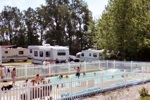
A fine swimming beach provides recreation for swimmers and sunbathers.
Boating
Non-powered watercraft and boats with electric motors only are permitted on the lake. A launch ramp provides access to the lake.
Fishing
Good catches of largemouth and smallmouth bass, crappie, bluegill, bullhead catfish, northern pike and carp can be taken from Harrison Lake. A valid Ohio fishing license is required.


Location
Harrison Lake State Park is located near Bryan, Hillsdale and Wauseon

Picnicking
Several quiet picnic areas are located in scenic areas of the park. Two shelter houses are available on a first-come, first-served basis or may be reserved with a deposit.
Trails
A 3.5-mile hiking trail circles the lake and provides the opportunity to explore the scenic lakeshore and woodlands.
Area Attractions
The Sauder Museum, Farm and Craft Village, just east of the intersection of S.R. 66 and S.R. 2 near Archbold, is a colorful reminder of the life in early Ohio. The 15-acre complex includes an 1860s home and barnyard, the Craft Village where talented artisans display their skills, and a museum displaying antique tools and farm implements. The restored barn on the premises houses a restaurant featuring country-style cooking.

Goll Woods State Nature Preserve, three miles northwest of Archbold, is one of the finest remaining examples of the Black Swamp forest. Some of the ancient oak trees are more than four feet in diameter and tower over the native shrubs and wildflowers found here. Nature photographers, birdwatchers and wildflower lovers will delight in the natural diversity that makes Goll Woods so unique.

The Fulton County Historical Society operates a museum at 229 Monroe Street in Wauseon. The museum, which illustrates the history of the Fulton County area is open Sunday afternoons without charge. Also located in Wauseon, in the city cemetery, is a memorial to the pioneering race car driver Barney Oldfield.

Maumee Bay State Park, east of Toledo, offers additional recreational opportunities with a resort lodge, cabins, Scottish-style golf course and campground.

Visitor Comments, Memories and Reviews
March 7 Family Memories ! by N.Freyer
park review stars; one to five Our family has been going to Harrison Lake for over thirty eight years. We have taught our kids to how ride there bikes, and many camping skills. As they are now grown Adults they are making there own family memories at Harrison Lake I rate this campground as one of best to make family memories! HAPPY CAMPING
May 17 DRAINED
park review stars; one to five They are putting in a new boat ramp. Not sure on the impact on the fish called and asked if they would restock and they said the water level would effect the fish. Hard too believe! but otherwise a nice park for the family
April 18 where is the water by Jeremy
park review stars; one to five I drove to harrison lake because I saw on the website you can catch good crappie!!!! When i got there it was like the lake was drained!!!!!Dont see why dnr or harrison lake web site did not mention this BIG WASTE OF MY TIME>>>
write a review read more reviews
Share On

Area Campgrounds
Loveberry's Funny Farm
19452 County Road 12
Pioneer, OH
419-737-2467
Sauder Village Campground
22611 Ohio 2
Archbold, OH
800-590-9755
Area Fishing Related Businesses
A J's Bait N Tackle
601 S State St
Pioneer, OH
(419) 737-2405
Area Accommodations (over 20 miles away)
businesss listing main photo
Campgrounds
Enjoy Southeast Michigan's Best Family Camping experience at our clean, quiet, friendly campground. Jumping Pillow, WiFi, Paddle Boats, Minigolf, Swimming, Bicycling and more
34.9 miles from park*
Nearby Hotels
Booking.com

Directions
From Cleveland, Ohio:Take the turnpike to Exit 3, take 108 North to U.S. 20Take a left on U.S. 20 through Fayette to County Road 27Turn left and go 2 miles to the parkFrom Columbus, Ohio:Take Route 23 North to 15 & 75 to Route 6. Route 6 West to State Route 66 North.Stay on 66 North to County Road M. 2 miles to South entrance of the park From Cincinnati, Ohio:Take Route 75 to Route 30 to Route 127.Take Route 127 North through Bryan and West Unity.North on 127 to Williams County Rd O. 2 1&Mac218;2 miles West of Fayette on U.S. 20 to County Road 27.Left (South) to County Road MN, Left to entranceFrom Wauseon, Ohio:Take 20A to Route 66, North on 66 to County Road M.West on County Road M to South entrance of the park

state route ranger badge
Ohio
62

Ohio State Parks

X